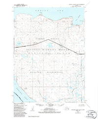
1952 Map of Nunivak Island A-6
USGS Topo · Published 1987About this map
The northern coastline of Nunivak Island meets the Bering Sea in this 1950s era survey, where traditional seasonal land use is marked by the presence of Kigoumiat and Dahloongamiut Summer Camp. These sites, along with a solitary Cabin near Nash Harbor, reflect the Indigenous subsistence patterns on the island before modern shifts in settlement. The landscape is defined by its coastal bluffs, such as Ahkwiryuk Bluff and Koweelik Bluff, and prominent landmarks like Ahkolikotak Head which guards the entrance to the harbor.
Find a feature on this map
27 named features on this map. Tap any name to fly to it.
Don’t see what you’re looking for? This feature index may not catch every label — zoom into the map to look around manually.
Map Details
Editions of this 1952 Nunivak Island A-6 Map
3 editions found
Other maps of this area

1951 · Cape Mendenhall
USGS Topo · 1:250,000

1951 · Nunivak Island
USGS Topo · 1:250,000

1952 · Nunivak Island A-7
USGS Topo · 1:63,360

1952 · Cape Mendenhall
USGS Topo · 1:250,000

1952 · Cape Mendenhall D-6
USGS Topo · 1:63,360

1952 · Nunivak Island A-6
USGS Topo · 1:63,360

1952 · Nunivak Island A-5
USGS Topo · 1:63,360
1952 · Nunivak Island B-5
USGS Topo · 1:63,360
1952 · Cape Mendenhall D-5
USGS Topo · 1:63,360

1954 · Nunivak Island
USGS Topo · 1:250,000