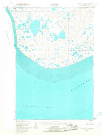
1952 Map of Nushagak Bay C-1
USGS Topo · Published 1967About this map
Bristol Bay meets the expansive Tidal Flats of the Alaska coastline in this mid-century survey. The landscape is defined by the convergence of Nushagak Bay and Kvichak Bay, where the shoreline is punctuated by prominent navigational landmarks like Etolin Point and the Etolin Point Beacon. Inland, the terrain is dominated by a dense network of unnamed lakes and ponds, indicating the low-lying, water-saturated nature of the coastal tundra during the early 1950s. The presence of several survey stations, including VABM Etolin Point and VABM Castor, reveals the technical efforts of the Army Corps of Engineers and the Geological Survey to precisely map this remote maritime environment. To the west, the broad expanse of Flounder Flat underscores the dynamic tidal nature of these northern waters.
Find a feature on this map
11 named features on this map. Tap any name to fly to it.
Don’t see what you’re looking for? This feature index may not catch every label — zoom into the map to look around manually.
Map Details
Editions of this 1952 Nushagak Bay C-1 Map
2 editions found
Other maps of this area

1945 · Nushagak Bay
USGS Topo · 1:250,000

1949 · Nushagak Bay
USGS Topo · 1:250,000

1951 · Nushagak Bay
USGS Topo · 1:250,000

1952 · Naknek
USGS Topo · 1:250,000
1952 · Nushagak Bay C-1
USGS Topo · 1:63,360

1952 · Naknek C-6
USGS Topo · 1:63,360

1952 · Nushagak Bay D-1
USGS Topo · 1:63,360
1952 · Nushagak Bay D-2
USGS Topo · 1:63,360

1952 · Naknek D-6
USGS Topo · 1:63,360

1964 · Nushagak Bay
USGS Topo · 1:250,000