
1950 Map of Nushagak Bay C-3
USGS Topo · Published 1955About this map
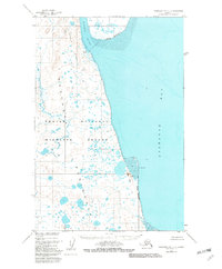
Igushik River flows southward along the eastern margin of the Nushagak Peninsula in this mid-century coastal survey. The landscape is defined by its complex hydrography, where the river meets the tidal reaches of Nushagak Bay. Of particular interest to genealogists and local historians is the location of Igushik (Site), appearing here as a former settlement or seasonal camp near the river mouth. The terrain along the coast is marked by the distinctive Nichols Hills and the long, protective stretch of Nichols Spit. Inland, the geography is characterized by the prominent Igushik Ridge and a dense network of small ponds and unnamed waterways that dominate the peninsula's interior. This 1950 data, compiled from aerial photography and earlier hydrographic charts, records the natural shoreline and navigational landmarks of the Alaska-Third Judicial Division before more modern coastal developments or shifts occurred.
Find a feature on this map
9 named features on this map. Tap any name to fly to it.
Don’t see what you’re looking for? This feature index may not catch every label — zoom into the map to look around manually.
Map Details
Editions of this 1950 Nushagak Bay C-3 Map
2 editions found
Other maps of this area

1945 · Nushagak Bay
USGS Topo · 1:250,000

1948 · Nushagak Bay D-4
USGS Topo · 1:63,360

1948 · Nushagak Bay D-3
USGS Topo · 1:63,360

1948 · Nushagak Bay C-4 And C-5
USGS Topo · 1:63,360

1949 · Nushagak Bay
USGS Topo · 1:250,000

1950 · Nushagak Bay B-4
USGS Topo · 1:63,360

1950 · Nushagak Bay C-4 And C-5
USGS Topo · 1:63,360
1950 · Nushagak Bay B-3
USGS Topo · 1:63,360

1951 · Nushagak Bay
USGS Topo · 1:250,000

1952 · Nushagak Bay D-3
USGS Topo · 1:63,360