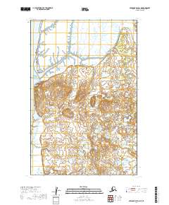
2019 Map of Nushagak Bay D-2 NE
USGS Topo · Published 2019About this map
Nushagak Bay dominates the western shoreline of this coastal landscape, where the tides of southwestern Alaska meet a complex network of wetlands and tidal flats. The settlement of Nushagak is situated prominently at Nushagak Point, overlooking the expansive waters. This area has long served as a critical location for the regional fishing industry and as a historic trading hub, given its strategic position near the mouth of the Nushagak River system.
Find a feature on this map
11 named features on this map. Tap any name to fly to it.
Don’t see what you’re looking for? This feature index may not catch every label — zoom into the map to look around manually.
Map Details
Editions of this 2019 Nushagak Bay D-2 NE Map
This is the sole edition of this map. No revisions or reprints were ever made.
Other maps of this area

1945 · Nushagak Bay
USGS Topo · 1:250,000

1949 · Nushagak Bay
USGS Topo · 1:250,000

1951 · Dillingham
USGS Topo · 1:250,000

1951 · Nushagak Bay
USGS Topo · 1:250,000

1952 · Nushagak Bay D-1
USGS Topo · 1:63,360

1952 · Dillingham A-7
USGS Topo · 1:63,360
1952 · Nushagak Bay D-2
USGS Topo · 1:63,360

1954 · Dillingham
USGS Topo · 1:250,000

1964 · Nushagak Bay
USGS Topo · 1:250,000
2019 · Nushagak Bay D-1 SW
USGS Topo · 1:25,000