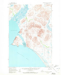
1950 Map of Nushagak Bay D-5
USGS Topo · Published 1972About this map
Kulukak Bay and the vast sweep of Bristol Bay dominate this coastal survey, where the glacial and fluvial processes of Southwest Alaska are on full display. The landscape is defined by the braided drainage systems of the Kanik River and the meandering paths of the Tuklung River and Titaluk River. These waterways reveal a complex network of wetlands and tidal flats that transition into the protected waters of Tivativak Bay. This mid-century mapping by the U.S. Coast and Geodetic Survey captures a remote wilderness without established roads or permanent settlements at the time of the aerial photography. The absence of infrastructure underscores the region's reliance on maritime and riverine access, typical of the Bristol Bay fishery and subsistence corridors during this era.
Find a feature on this map
6 named features on this map. Tap any name to fly to it.
Don’t see what you’re looking for? This feature index may not catch every label — zoom into the map to look around manually.
Map Details
Editions of this 1950 Nushagak Bay D-5 Map
2 editions found
Other maps of this area

1945 · Nushagak Bay
USGS Topo · 1:250,000

1948 · Nushagak Bay D-4
USGS Topo · 1:63,360

1948 · Nushagak Bay C-4 And C-5
USGS Topo · 1:63,360

1949 · Nushagak Bay
USGS Topo · 1:250,000

1950 · Nushagak Bay C-4 And C-5
USGS Topo · 1:63,360

1950 · Nushagak Bay D-5
USGS Topo · 1:63,360

1950 · Nushagak Bay D-6
USGS Topo · 1:63,360

1951 · Goodnews
USGS Topo · 1:250,000

1951 · Nushagak Bay
USGS Topo · 1:250,000

1952 · Nushagak Bay D-4
USGS Topo · 1:63,360