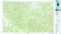
1981 Map of Nutrioso
USGS Topo · Published 1996About this map
The Mogollon Rim and White Mountains define this high-altitude landscape where the Fort Apache Indian Reservation and San Carlos Indian Reservation converge. This 1981 survey documents the intersection of several distinct tribal, national forest, and county boundaries at the height of the modern era. The drainage of the White River and Black River systems is clearly delineated, alongside recreational and water storage landmarks such as Big Lake, Hawley Lake, and Luna Lake.
Find a feature on this map
44 named features on this map. Tap any name to fly to it.
Don’t see what you’re looking for? This feature index may not catch every label — zoom into the map to look around manually.
Map Details
Editions of this 1981 Nutrioso Map
2 editions found
Other maps of this area

1886 · St Johns
USGS Topo · 1:250,000

1886 · Holbrook
USGS Topo · 1:250,000

1892 · St Johns
USGS Topo · 1:250,000

1893 · Holbrook
USGS Topo · 1:250,000

1910 · Mogollon
USGS Topo · 1:125,000

1912 · Mogollon
USGS Topo · 1:125,000

1913 · Morenci
USGS Topo · 1:125,000

1915 · Morenci
USGS Topo · 1:125,000

1915 · Reserve
USGS Topo · 1:125,000

1918 · Reserve
USGS Topo · 1:125,000