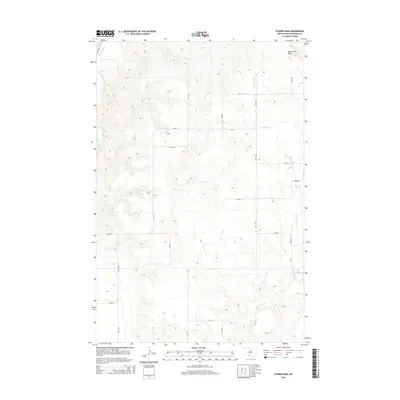
2014 Map of Nygren Dam
USGS Topo · Published 2014About this map
Oak Coulee Ridge dominates the northern landscape of this Morton County survey, overlooking a high-plains terrain defined by the winding course of the Heart River in the west and Chanta Peta Cr in the east. The map illustrates a contemporary rural framework where a precise grid of local roads, such as 57th St and 37th Ave, organizes the agricultural interior. This 2014 documentation highlights the modern county road system, featuring the intersection of Cr-136 and Cr-135. Unlike earlier historical surveys, this era shows a landscape managed by utility and connectivity, where the drainage patterns of the coulees and creeks dictate the placement of local thoroughfares through the North Dakota prairie.
Find a feature on this map
20 named features on this map. Tap any name to fly to it.
Don’t see what you’re looking for? This feature index may not catch every label — zoom into the map to look around manually.
Map Details
Editions of this 2014 Nygren Dam Map
This is the sole edition of this map. No revisions or reprints were ever made.
Other maps of this area

1954 · Bismarck
USGS Topo · 1:250,000

1958 · Bismarck
USGS Topo · 1:250,000

1980 · Green Ridge
USGS Topo · 1:24,000

1980 · Otter Creek East
USGS Topo · 1:24,000

1980 · Fallon NE
USGS Topo · 1:24,000

1980 · Burgess
USGS Topo · 1:24,000

1980 · Dogtooth Buttes
USGS Topo · 1:24,000
1980 · Fish Creek Lake
USGS Topo · 1:24,000

1980 · Nygren Dam
USGS Topo · 1:24,000
1980 · Elgin
USGS Topo · 1:100,000