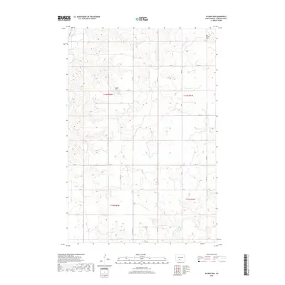
2018 Map of Nygren Dam
USGS Topo · Published 2018About this map
Nygren Dam and the surrounding agricultural landscape of Morton County define this portion of the northern plains. The terrain is characterized by the meandering path of the Heart River in the northwest and the prominent Oak Coulee Ridge rising in the northeast. This 2018 survey illustrates a well-defined sectional grid system, with rural corridors like Co Rd 136 and 33rd Ave facilitating movement between scattered farmsteads. Water management and drainage are central to the landscape, as evidenced by the namesake dam and the flow of Chanta Peta Cr through the eastern sections. The map reveals the meticulous organization of rural North Dakota, where secondary routes such as Lake Patricia Rd and Co Rd 135 connect remote properties to the broader county infrastructure.
Find a feature on this map
24 named features on this map. Tap any name to fly to it.
Don’t see what you’re looking for? This feature index may not catch every label — zoom into the map to look around manually.
Map Details
Editions of this 2018 Nygren Dam Map
This is the sole edition of this map. No revisions or reprints were ever made.
Other maps of this area

1954 · Bismarck
USGS Topo · 1:250,000

1958 · Bismarck
USGS Topo · 1:250,000

1980 · Green Ridge
USGS Topo · 1:24,000

1980 · Otter Creek East
USGS Topo · 1:24,000

1980 · Fallon NE
USGS Topo · 1:24,000

1980 · Burgess
USGS Topo · 1:24,000

1980 · Dogtooth Buttes
USGS Topo · 1:24,000
1980 · Fish Creek Lake
USGS Topo · 1:24,000

1980 · Nygren Dam
USGS Topo · 1:24,000
1980 · Elgin
USGS Topo · 1:100,000