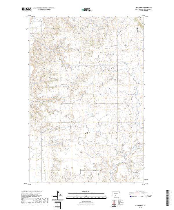
2024 Map of Nygren Dam
USGS Topo · Published 2024About this map
Chanta Peta Creek meanders through the drainages of southeastern Morton County, defining the local hydrology within this section of the Great Plains. The landscape is characterized by the prominent elevation of Oak Coulee Ridge, which provides a geographic anchor in the northeast. This 2024 survey documents a predominantly rural township structure, divided by the Public Land Survey System boundaries of t136n r84w, t136n r83w, and their southern counterparts. Transportation is defined by a grid of section-line roads, including Co Rd 136 and Lake Patrica Rd, which serve the scattered farmsteads and agricultural plots of this high-plains environment.
Find a feature on this map
14 named features on this map. Tap any name to fly to it.
Don’t see what you’re looking for? This feature index may not catch every label — zoom into the map to look around manually.
Map Details
Editions of this 2024 Nygren Dam Map
This is the sole edition of this map. No revisions or reprints were ever made.
Other maps of this area

1954 · Bismarck
USGS Topo · 1:250,000

1958 · Bismarck
USGS Topo · 1:250,000

1980 · Green Ridge
USGS Topo · 1:24,000

1980 · Otter Creek East
USGS Topo · 1:24,000

1980 · Fallon NE
USGS Topo · 1:24,000

1980 · Burgess
USGS Topo · 1:24,000

1980 · Dogtooth Buttes
USGS Topo · 1:24,000
1980 · Fish Creek Lake
USGS Topo · 1:24,000

1980 · Nygren Dam
USGS Topo · 1:24,000
1980 · Elgin
USGS Topo · 1:100,000