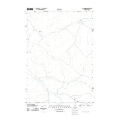
2011 Map of O T O Ranch
USGS Topo · Published 2011About this map
Seventy-seven Ranch and the isolated drainage systems of Sheridan County define this high-plains landscape as it appeared in the early 21st century. The terrain is marked by a complex network of intermittent watercourses, including the North Fork, Lotspeich Prong, and Randall Prong of Waddle Creek, which highlight the importance of water management in this arid ranching environment. This reliance on seasonal flow is anchored by the Fordyce Deer Creek Dam along the South Fork Deer Creek.
Find a feature on this map
15 named features on this map. Tap any name to fly to it.
Don’t see what you’re looking for? This feature index may not catch every label — zoom into the map to look around manually.
Map Details
Editions of this 2011 O T O Ranch Map
This is the sole edition of this map. No revisions or reprints were ever made.
Other maps of this area

1909 · Sheridan
USGS Topo · 1:125,000

1911 · Sheridan
USGS Topo · 1:125,000

1954 · Hardin
USGS Topo · 1:250,000

1955 · Sheridan
USGS Topo · 1:250,000

1957 · Hardin
USGS Topo · 1:250,000

1958 · Hardin
USGS Topo · 1:250,000

1958 · Sheridan
USGS Topo · 1:250,000

1962 · Sheridan
USGS Topo · 1:250,000

1967 · Holmes Ranch
USGS Topo · 1:24,000
1967 · Pine Butte School
USGS Topo · 1:24,000