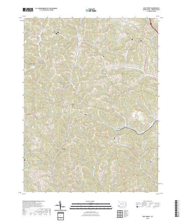
2023 Map of Oak Forest
USGS Topo · Published 2023About this map
The community of Oak Forest and the nearby Spraggs settlement anchor this modern survey of Greene County. The area is defined by a dense network of valley runs and high ridges, where the Warrior Trl follows the natural topography across the landscape. The region’s deep genealogical roots are evident in the numerous family and community burial grounds documented here, including both the White Church Cem - Old and White Church Cem - New, as well as the Lapping Cem, Gordon Cem, and Phillips Cem. Waterways like Smith Creek and Whiteley Creek dictate the local road patterns, such as Smith Creek RD, which connects the small crossroads and hillsides. The map provides a clear look at contemporary land use in a region where historical sites like Claughton Chapel Cem remain preserved alongside modern landmarks like Brant Hill.
Find a feature on this map
85 named features on this map. Tap any name to fly to it.
Don’t see what you’re looking for? This feature index may not catch every label — zoom into the map to look around manually.
Map Details
Editions of this 2023 Oak Forest Map
This is the sole edition of this map. No revisions or reprints were ever made.
Other maps of this area

1901 · Waynesburg
USGS Topo · 1:62,500

1904 · Blacksville
USGS Topo · 1:62,500

1904 · Waynesburg
USGS Topo · 1:62,500

1905 · Mannington
USGS Topo · 1:62,500

1905 · Rogersville
USGS Topo · 1:62,500

1923 · Blacksville
USGS Topo · 1:62,500

1923 · Mannington
USGS Topo · 1:62,500

1925 · Blacksville
USGS Topo · 1:62,500

1926 · Mannington
USGS Topo · 1:62,500

1949 · Clarksburg
USGS Topo · 1:250,000