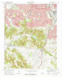
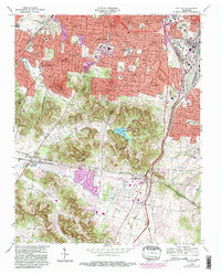
1968 Map of Oak Hill
USGS Topo · Published 1968About this map
Belle Meade and Oak Hill anchor this detailed landscape just south of Nashville, where suburban expansion meets the winding ridges of the Little Harpeth River valley. The map reveals a sophisticated mid-century community defined by institutions like the Vanderbilt University Observatory and Harpeth Hall Sch, alongside established religious centers such as St Pauls Ch and Harpeth Ch. The terrain transitions from the developed corridors of Green Hills and Berry Hill to the preserved waters of Radnor Lake, surrounded by significant elevation changes. Historically important transit routes, including the Louisville and Nashville railroad and the Granny White Pike, segment the residential areas. The southern portion of the sheet shows the transition into Williamson Co, where more open land and scattered family-named landmarks like Reed Hol and Murry Branch characterize the geography.
Find a feature on this map
64 named features on this map. Tap any name to fly to it.
Don’t see what you’re looking for? This feature index may not catch every label — zoom into the map to look around manually.
Map Details
Editions of this 1968 Oak Hill Map
5 editions found
Other maps of this area

1903 · Nashville
USGS Topo · 1:125,000

1909 · Franklin
USGS Topo · 1:62,500

1932 · Hermitage
USGS Topo · 1:62,500

1932 · Nashville
USGS Topo · 1:62,500

1942 · Lebanon
USGS Topo · 1:100,000

1946 · Leipers Fork
USGS Topo · 1:24,000

1949 · Leipers Fork
USGS Topo · 1:24,000

1949 · Franklin
USGS Topo · 1:24,000

1952 · Nashville West
USGS Topo · 1:24,000

1952 · Nashville East
USGS Topo · 1:24,000