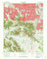
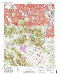
1968 Map of Oak Hill
USGS Topo · Published 1971About this map
Nashville's southern suburban expansion is documented here as residential growth pushes toward the Williamson County line. The map illustrates a transition from the dense urban grid of Berry Hill and Woodbine to the estates of Belle Meade and the wooded hills of Forest Hills. The landscape is anchored by significant institutional landmarks, including David Lipscomb College, the Vanderbilt University Observatory, and the Governors Mansion. A complex network of historic routes like Granny White Pike and Hillsboro Rd weaves through the topography, tracing the paths of earlier commerce and settlement.
Find a feature on this map
56 named features on this map. Tap any name to fly to it.
Don’t see what you’re looking for? This feature index may not catch every label — zoom into the map to look around manually.
Map Details
Editions of this 1968 Oak Hill Map
5 editions found
Other maps of this area

1903 · Nashville
USGS Topo · 1:125,000

1909 · Franklin
USGS Topo · 1:62,500

1932 · Hermitage
USGS Topo · 1:62,500

1932 · Nashville
USGS Topo · 1:62,500

1942 · Lebanon
USGS Topo · 1:100,000

1946 · Leipers Fork
USGS Topo · 1:24,000

1949 · Leipers Fork
USGS Topo · 1:24,000

1949 · Franklin
USGS Topo · 1:24,000

1952 · Nashville West
USGS Topo · 1:24,000

1952 · Nashville East
USGS Topo · 1:24,000