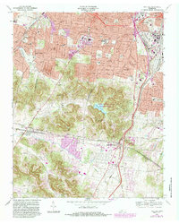
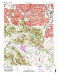
1968 Map of Oak Hill
USGS Topo · Published 1984About this map
The southern suburbs of Nashville reveal a landscape in transition, where the wooded ridges of the State Natural and Wildlife Refuge surrounding Radnor Lake meet the rapidly expanding residential enclaves of Belle Meade and Oak Hill. This 1968 survey, with later revisions, shows the suburban development pushing south toward the Williamson County line, yet large institutional properties and family estates still define much of the character. Key cultural landmarks like the Governors Mansion and the Vanderbilt University Observatory are situated among the hills, while the Radnor Yards and the Seaboard rail line mark the industrial and transport corridor to the east. Educational and religious centers such as David Lipscomb College and St Bartholomews Ch anchor the community, alongside historic sites like Robertson Academy and the extensive grounds of Woodlawn Cemetery.
Find a feature on this map
59 named features on this map. Tap any name to fly to it.
Don’t see what you’re looking for? This feature index may not catch every label — zoom into the map to look around manually.
Map Details
Editions of this 1968 Oak Hill Map
5 editions found
Other maps of this area

1903 · Nashville
USGS Topo · 1:125,000

1909 · Franklin
USGS Topo · 1:62,500

1932 · Hermitage
USGS Topo · 1:62,500

1932 · Nashville
USGS Topo · 1:62,500

1942 · Lebanon
USGS Topo · 1:100,000

1946 · Leipers Fork
USGS Topo · 1:24,000

1949 · Leipers Fork
USGS Topo · 1:24,000

1949 · Franklin
USGS Topo · 1:24,000

1952 · Nashville West
USGS Topo · 1:24,000

1952 · Nashville East
USGS Topo · 1:24,000