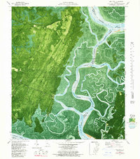
1979 Map of Oak Level
USGS Topo · Published 1987About this map
Ogeechee River and Bear River dominate this coastal Georgia landscape, where a dense network of tidal creeks and marshes meets the high ground of the Bryan and Chatham county line. In the late 1970s, the area retained its intricate water-bound geography, with the Florida Passage Intracoastal Waterway cutting through Narrows and past Torry Bear Island. Small coastal settlements and landings are scattered throughout the maritime forest, including Kilkenny, Belvidere, and Oak Level. This orthophotomat specifically integrates 1974 aerial imagery with 1975 field checks, providing a detailed record of the shifting shoreline and the relationship between the low-lying islands like Queen Bess Island and the inland hammocks. To the south, the Medway River defines the border near Fancy Hall and the Retreat landmark, while the Kilkenny Road serves as the primary terrestrial artery through the dense pine and oak cover.
Find a feature on this map
41 named features on this map. Tap any name to fly to it.
Don’t see what you’re looking for? This feature index may not catch every label — zoom into the map to look around manually.
Map Details
Editions of this 1979 Oak Level Map
3 editions found
Other maps of this area

1920 · Sapelo River
USGS Topo · 1:62,500

1920 · Limerick
USGS Topo · 1:62,500

1928 · St Catherines Island
USGS Topo · 1:62,500

1943 · St Catherines Island
USGS Topo · 1:62,500

1943 · Sapelo River
USGS Topo · 1:62,500

1944 · Limerick
USGS Topo · 1:62,500

1944 · Ossabaw Island
USGS Topo · 1:62,500

1945 · St. Catherine's Island
USGS Topo · 1:62,500

1945 · Ossabaw Island
USGS Topo · 1:62,500

1945 · Sapelo River
USGS Topo · 1:62,500