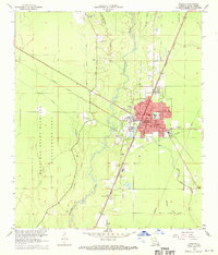
1968 Map of Oakdale
USGS Topo · Published 1970About this map
The Atchison Topeka and Santa Fe and Missouri Pacific railroads converge in Oakdale, marking this Louisiana town as a significant transport and industrial hub in the late 1960s. The presence of a refinery and multiple landing strips, including Murray Airport and the Oakdale Municipal Airport, underscores the area's economic activity during this era. To the west, the landscape transitions into the preserved territory of the West Bay State Wildlife Management Area, defined by the winding course of Curtis Creek. For family historians, the sheet is exceptionally detailed with local landmarks such as Oak Hill Ch, Cryer Cem, and Sacred Heart Cem, alongside several parish schools that anchored the community's residential life. The river-and-rail topography is further defined by an extensive network of pipelines and old railroad grades, reflecting a shifting infrastructure as newer industries integrated with established timber and transit corridors.
Find a feature on this map
36 named features on this map. Tap any name to fly to it.
Don’t see what you’re looking for? This feature index may not catch every label — zoom into the map to look around manually.
Map Details
Editions of this 1968 Oakdale Map
3 editions found
Other maps of this area

1935 · Beaver
USGS Topo · 1:31,680

1935 · Pawnee
USGS Topo · 1:31,680

1935 · Oakdale
USGS Topo · 1:31,680

1942 · Oakdale
USGS Topo · 1:62,500

1947 · Foley
USGS Topo · 1:31,680

1947 · Steep Gully
USGS Topo · 1:31,680

1947 · Pine Chapel
USGS Topo · 1:31,680

1947 · Bond
USGS Topo · 1:31,680

1947 · Elizabeth
USGS Topo · 1:31,680

1948 · Elizabeth
USGS Topo · 1:24,000