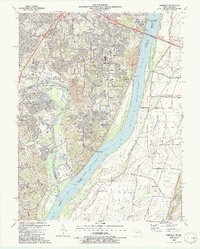
1991 Map of Oakville
USGS Topo · Published 1991About this map
Jefferson Barracks National Cemetery and the adjacent Jefferson Barracks Veterans Hospital anchor the northern edge of this suburban landscape where the Mississippi River meets the Meramec River. The residential growth of Oakville and Mattese is captured here in detail, showing a network of schools such as Wohlwend Sch and Troutwein Sch alongside numerous religious institutions including Nazareth Convent and the Monastery of St Clare.
Find a feature on this map
76 named features on this map. Tap any name to fly to it.
Don’t see what you’re looking for? This feature index may not catch every label — zoom into the map to look around manually.
Map Details
Editions of this 1991 Oakville Map
2 editions found
Other maps of this area

1888 · St. Louis
USGS Topo · 1:62,500

1910 · Waterloo
USGS Topo · 1:62,500

1912 · Kimmswick
USGS Topo · 1:62,500

1913 · Waterloo
USGS Topo · 1:62,500

1916 · Kimmswick
USGS Topo · 1:62,500

1933 · Jefferson Barracks
USGS Topo · 1:24,000

1933 · Cahokia
USGS Topo · 1:24,000

1933 · Kirkwood
USGS Topo · 1:24,000

1934 · Cahokia
USGS Topo · 1:24,000
1940 · Cahokia
USGS Topo · 1:24,000