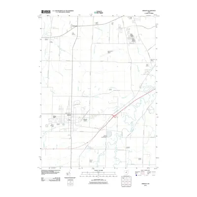
2010 Map of Oberlin
USGS Topo · Published 2010About this map
The college town of Oberlin anchors this study of Lorain County, reflecting a landscape where academic history meets persistent agricultural and industrial infrastructure. A remarkable concentration of burial grounds, including the Westwood Cemetery and the Agudath Achim Cemetery, offers a rich resource for genealogical research. The map captures the transition from the city's residential grid to the outlying orchards and farmsteads, such as Grobe Fruit Farm and Vita-ful Orchards. Drainage patterns are meticulously documented through a complex network of artificial and natural waterways like Squires Ditch and Herrick Ditch, which feed into the West Branch Black River. Transportation and recreation are well-represented by the Lorain County Regional Airport and the Lorain County Speedway, while smaller private aviation fields like Dechant Farms Airport dot the rural surroundings, illustrating the area's diverse land use in the early twenty-first century.
Find a feature on this map
54 named features on this map. Tap any name to fly to it.
Don’t see what you’re looking for? This feature index may not catch every label — zoom into the map to look around manually.
Map Details
Editions of this 2010 Oberlin Map
This is the sole edition of this map. No revisions or reprints were ever made.
Other maps of this area

1901 · Oberlin
USGS Topo · 1:62,500

1903 · Vermilion
USGS Topo · 1:62,500

1903 · Oberlin
USGS Topo · 1:62,500

1904 · Wellington
USGS Topo · 1:62,500

1906 · Wellington
USGS Topo · 1:62,500

1908 · New London
USGS Topo · 1:62,500

1953 · Grafton
USGS Topo · 1:24,000

1953 · Avon
USGS Topo · 1:24,000

1956 · Toledo
USGS Topo · 1:250,000

1959 · Vermilion East
USGS Topo · 1:24,000