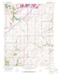
1956 Map of Ocheltree
USGS Topo · Published 1971About this map
Olathe anchors the northern portion of this landscape, showing significant suburban expansion by the early 1970s while the southern reaches toward Spring Hill maintain a rural, grid-based agricultural character. Two major rail lines, the Atchison Topeka and Santa Fe and the St Louis San Francisco, intersect the terrain, dictating the placement of small siding settlements like Bonita and Ocheltree. The area is defined by its water management and civic infrastructure, from the New Olathe Lake and Olathe Lake reservoirs to the Filtration Plant and municipal Water Tank. Local history is preserved in rural cornerstones such as Hilltop Sch and the Calvary Cem, providing a detailed view of Johnson County's transition from a rail-dependent farming community to an emerging suburban hub.
Find a feature on this map
31 named features on this map. Tap any name to fly to it.
Don’t see what you’re looking for? This feature index may not catch every label — zoom into the map to look around manually.
Map Details
Editions of this 1956 Ocheltree Map
4 editions found
Other maps of this area

1887 · Olathe
USGS Topo · 1:125,000

1893 · Olathe
USGS Topo · 1:125,000

1935 · Olathe
USGS Topo · 1:24,000

1935 · Lenexa
USGS Topo · 1:24,000

1943 · Lenexa
USGS Topo · 1:31,680

1943 · Olathe
USGS Topo · 1:31,680

1947 · Lawrence
USGS Topo · 1:250,000

1950 · Lawrence
USGS Topo · 1:250,000

1951 · De Soto
USGS Topo · 1:24,000

1956 · Stilwell
USGS Topo · 1:24,000