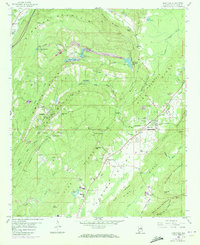
1958 Map of Odenville
USGS Topo · Published 1973About this map
Odenville stands as a central hub in this St. Clair County landscape, defined by a series of parallel ridges including Oak Mountain Ridge and Pine Ridge. The region's mid-century industrial character is clearly visible through extensive strip mining activity and numerous tailings piles concentrated near Margaret. These mining operations are interwoven with a network of small communities and rural institutions, such as Macedonia Church and the Odenville High School.
Find a feature on this map
96 named features on this map. Tap any name to fly to it.
Don’t see what you’re looking for? This feature index may not catch every label — zoom into the map to look around manually.
Map Details
Editions of this 1958 Odenville Map
2 editions found
Other maps of this area

1889 · Springville
USGS Topo · 1:125,000

1889 · Birmingham
USGS Topo · 1:125,000

1892 · Birmingham
USGS Topo · 1:125,000

1892 · Springville
USGS Topo · 1:125,000

1895 · Birmingham
USGS Topo · 1:125,000

1905 · Leeds
USGS Topo · 1:62,500

1907 · Birmingham
USGS Topo · 1:125,000

1907 · Leeds
USGS Topo · 1:62,500

1953 · Birmingham
USGS Topo · 1:250,000

1956 · Birmingham
USGS Topo · 1:250,000