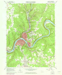
1963 Map of Oil City
USGS Topo · Published 1973About this map
Oil City dominates the confluence of the Allegheny River and Oil Creek, serving as a central hub for the region's industrial and rail infrastructure during the early 1970s. The landscape is characterized by the tight bends of the river, where the Penn Central and Erie-Lackawanna railroads follow the water's edge to serve outlying settlements like Rouseville, Siverly, and Reno. Evidence of the area's resource-driven economy is visible in the numerous oil wells and Strip Mines scattered across the uplands of Cranberry and Oakland townships.
Find a feature on this map
86 named features on this map. Tap any name to fly to it.
Don’t see what you’re looking for? This feature index may not catch every label — zoom into the map to look around manually.
Map Details
Editions of this 1963 Oil City Map
3 editions found
Other maps of this area

1909 · Franklin
USGS Topo · 1:62,500

1911 · Franklin
USGS Topo · 1:62,500

1922 · Oil City
USGS Topo · 1:48,000

1924 · Oil City
USGS Topo · 1:62,500

1927 · Townville
USGS Topo · 1:48,000

1927 · Titusville
USGS Topo · 1:62,500

1932 · Townville
USGS Topo · 1:62,500

1933 · Titusville
USGS Topo · 1:62,500

1943 · Oil City
USGS Topo · 1:62,500

1945 · Townville
USGS Topo · 1:62,500