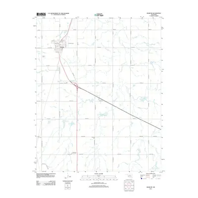
2012 Map of Okarche
USGS Topo · Published 2012About this map
Okarche sits at the northern edge of this Canadian County landscape, serving as a hub for the surrounding agricultural plains. The town's layout is defined by a traditional grid including Okarche Ave and N Industrial Blvd, supported by the small Okarche Airport just to the east. The landscape's character is heavily influenced by the winding path of Uncle Johns Creek, which is managed by a series of flood control structures such as Uncle John Cr Site 11 Reservoir and Uncle John Cr Site 7 Reservoir. These reservoirs are scattered across the section lines, reflecting a modern approach to managing the local watershed.
Find a feature on this map
49 named features on this map. Tap any name to fly to it.
Don’t see what you’re looking for? This feature index may not catch every label — zoom into the map to look around manually.
Map Details
Editions of this 2012 Okarche Map
This is the sole edition of this map. No revisions or reprints were ever made.
Other maps of this area

1892 · Kingfisher
USGS Topo · 1:125,000

1893 · Fort Reno
USGS Topo · 1:62,500

1893 · Loyal
USGS Topo · 1:62,500

1895 · Kingfisher
USGS Topo · 1:125,000

1941 · Fort Reno
USGS Topo · 1:62,500

1942 · Fort Reno
USGS Topo · 1:62,500

1949 · Fort Reno
USGS Topo · 1:62,500

1954 · Oklahoma City
USGS Topo · 1:250,000

1955 · Clinton
USGS Topo · 1:250,000

1957 · Clinton
USGS Topo · 1:250,000