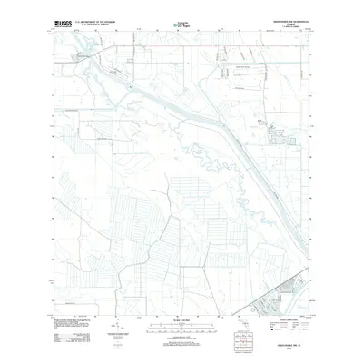
2012 Map of Okeechobee NW
USGS Topo · Published 2012About this map
The Kissimmee River dominates this landscape as it flows toward its southern terminus at Lake Okeechobee. This 2012 survey illustrates the highly managed hydrology of the region, where natural features like Popash Slough and Lemkin Cr coexist with engineered infrastructure such as Canal Lake and the prominent Hoover Dike Rd. The area’s aviation history and rural development are evident through the presence of River Oak Airport and Sunset Strip Airpark, reflecting a specialized land use pattern near the riverbanks.
Find a feature on this map
54 named features on this map. Tap any name to fly to it.
Don’t see what you’re looking for? This feature index may not catch every label — zoom into the map to look around manually.
Map Details
Editions of this 2012 Okeechobee NW Map
This is the sole edition of this map. No revisions or reprints were ever made.
Other maps of this area

1952 · Okeechobee NW
USGS Topo · 1:24,000

1952 · Okeechobee
USGS Topo · 1:24,000

1953 · Fort Basinger
USGS Topo · 1:24,000

1953 · Brighton
USGS Topo · 1:24,000

1953 · Brighton SE
USGS Topo · 1:24,000

1953 · Okeechobee SW
USGS Topo · 1:24,000

1953 · Taylor Creek SW
USGS Topo · 1:24,000

1953 · Taylor Creek SE
USGS Topo · 1:24,000

1956 · Fort Pierce
USGS Topo · 1:250,000

1958 · Fort Pierce
USGS Topo · 1:250,000