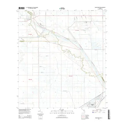
2015 Map of Okeechobee NW
USGS Topo · Published 2015About this map
The Kissimmee River meanders south toward Lake Okeechobee in this 2015 study, marking the winding boundary between Okeechobee, Highlands, and Glades Counties. The settlement of Buckhead Ridge anchors the southern edge of the map, showing a dense network of residential streets including Chobee Loop and Linda Rd situated near the intersection of SR-78. Aviation infrastructure is prominent in the northern reaches, represented by the River Oak Airport and the Sunset Strip Airpark.
Find a feature on this map
49 named features on this map. Tap any name to fly to it.
Don’t see what you’re looking for? This feature index may not catch every label — zoom into the map to look around manually.
Map Details
Editions of this 2015 Okeechobee NW Map
This is the sole edition of this map. No revisions or reprints were ever made.
Other maps of this area

1952 · Okeechobee NW
USGS Topo · 1:24,000

1952 · Okeechobee
USGS Topo · 1:24,000

1953 · Fort Basinger
USGS Topo · 1:24,000

1953 · Brighton
USGS Topo · 1:24,000

1953 · Brighton SE
USGS Topo · 1:24,000

1953 · Okeechobee SW
USGS Topo · 1:24,000

1953 · Taylor Creek SW
USGS Topo · 1:24,000

1953 · Taylor Creek SE
USGS Topo · 1:24,000

1956 · Fort Pierce
USGS Topo · 1:250,000

1958 · Fort Pierce
USGS Topo · 1:250,000