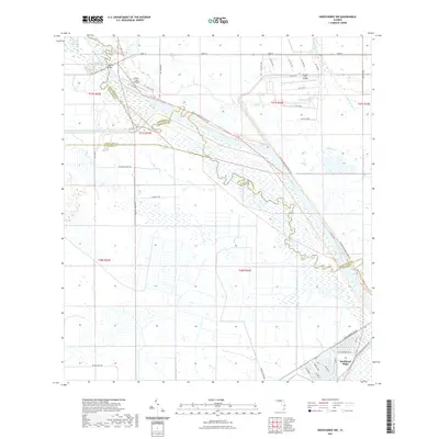
2021 Map of Okeechobee NW
USGS Topo · Published 2021About this map
The Kissimmee River meanders across this Central Florida landscape, marking the boundary lines between Highlands, Okeechobee, and Glades counties. The river valley is a complex of wetlands and natural drainage features like Popash Slough and Grogan Lake, contrasted by the straight engineered lines of Canal C-41A. In the south, the settlement of Buckhead Ridge sits at the edge of the marshes, organized by a network of local roads such as Chobee Loop and Linda Gardens Rd NE. Transportation through this often-saturated terrain relies on infrastructure like the Harding Bridge and the Florida National Scenic Trl, which follows the river corridor. Small-scale aviation is represented by private facilities including River Oak Airport and the Sunset Strip Airpark, serving the remote communities and agricultural operations of the interior.
Find a feature on this map
39 named features on this map. Tap any name to fly to it.
Don’t see what you’re looking for? This feature index may not catch every label — zoom into the map to look around manually.
Map Details
Editions of this 2021 Okeechobee NW Map
This is the sole edition of this map. No revisions or reprints were ever made.
Other maps of this area

1952 · Okeechobee NW
USGS Topo · 1:24,000

1952 · Okeechobee
USGS Topo · 1:24,000

1953 · Fort Basinger
USGS Topo · 1:24,000

1953 · Brighton
USGS Topo · 1:24,000

1953 · Brighton SE
USGS Topo · 1:24,000

1953 · Okeechobee SW
USGS Topo · 1:24,000

1953 · Taylor Creek SW
USGS Topo · 1:24,000

1953 · Taylor Creek SE
USGS Topo · 1:24,000

1956 · Fort Pierce
USGS Topo · 1:250,000

1958 · Fort Pierce
USGS Topo · 1:250,000