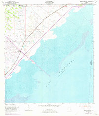
1953 Map of Okeechobee SW
USGS Topo · Published 1973About this map
Lake Okeechobee dominates the southeastern half of this quadrangle, its shoreline defined by a massive Levee and a series of Spoil Banks. The landscape reveals the intensive mid-century water management efforts by the U.S. Corps of Engineers, centered around the Indian Prairie Canal where it empties into the lake. On the landward side of the levee, the topography is exceptionally flat, punctuated by scattered marshy depressions and the controlled drainage channels typical of the Florida Everglades region during this era. A significant portion of the northern terrain is occupied by the Brighton Indian Reservation, while technical monitoring of the lake's levels is evidenced by the Gaging Station BM 22. This survey reflects the mid-1950s infrastructure before 1970s revisions added further detail to the roadway and canal systems.
Find a feature on this map
7 named features on this map. Tap any name to fly to it.
Don’t see what you’re looking for? This feature index may not catch every label — zoom into the map to look around manually.
Map Details
Editions of this 1953 Okeechobee SW Map
2 editions found
Other maps of this area

1952 · Okeechobee NW
USGS Topo · 1:24,000

1952 · Okeechobee
USGS Topo · 1:24,000

1953 · Brighton
USGS Topo · 1:24,000

1953 · Brighton SE
USGS Topo · 1:24,000

1953 · Okeechobee SW
USGS Topo · 1:24,000

1956 · West Palm Beach
USGS Topo · 1:250,000

1956 · Fort Pierce
USGS Topo · 1:250,000

1957 · West Palm Beach
USGS Topo · 1:250,000

1958 · Fort Pierce
USGS Topo · 1:250,000

1958 · West Palm Beach
USGS Topo · 1:250,000