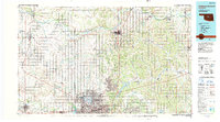
1990 Map of Oklahoma City North
USGS Topo · Published 1990About this map
Oklahoma City and its northern suburbs are shown here in 1990 as the metropolitan area expanded toward Edmond and The Village. The map details a landscape transition from dense urban development to the surrounding agrarian and oil-producing regions. Vital water infrastructure is prominent, including Lake Hefner, Lake Overholser, and the relatively new Lake Arcadia, which regulate the flow of the North Canadian River. To the west, the El Reno Federal Reformatory sits near the crossing of major rail lines.
Find a feature on this map
61 named features on this map. Tap any name to fly to it.
Don’t see what you’re looking for? This feature index may not catch every label — zoom into the map to look around manually.
Map Details
Editions of this 1990 Oklahoma City North Map
This is the sole edition of this map. No revisions or reprints were ever made.
Other maps of this area

1892 · Moore
USGS Topo · 1:62,500

1892 · Guthrie
USGS Topo · 1:62,500

1892 · Edmond
USGS Topo · 1:62,500

1892 · Kingfisher
USGS Topo · 1:125,000

1893 · Fort Reno
USGS Topo · 1:62,500

1893 · Mulhall
USGS Topo · 1:62,500

1893 · Oklahoma City
USGS Topo · 1:62,500

1893 · Lovell
USGS Topo · 1:62,500

1893 · Buggy Creek
USGS Topo · 1:62,500

1893 · Hennessey
USGS Topo · 1:62,500