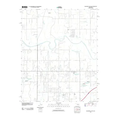
2009 Map of Oklahoma City SW
USGS Topo · Published 2009About this map
The Canadian River winds through this southwestern portion of Oklahoma City, defining a landscape where rural legacy meets modern suburban expansion. While the northern reaches are marked by recreation and assembly spaces like Camp Kickapoo and the Pentecostal Campground, the southern portion is increasingly defined by a grid of residential developments and rural roads such as Brentwood Manor and E 1180 Rd. Notable topographical and infrastructural markers include Barton's Butte and the Low Pass Airport, along with several water management features like Timberlake Dam and numerous unnamed reservoirs. Several tributaries, including Coal Creek and Cool Creek, drain the territory, highlighting the area's natural hydrology amidst the encroaching local road network of N Sara Rd and S Council Rd.
Find a feature on this map
57 named features on this map. Tap any name to fly to it.
Don’t see what you’re looking for? This feature index may not catch every label — zoom into the map to look around manually.
Map Details
Editions of this 2009 Oklahoma City SW Map
This is the sole edition of this map. No revisions or reprints were ever made.
Other maps of this area

1893 · Oklahoma City
USGS Topo · 1:62,500

1893 · Minco
USGS Topo · 1:62,500

1904 · Chickasha
USGS Topo · 1:125,000

1954 · Oklahoma City
USGS Topo · 1:250,000

1956 · Oklahoma City
USGS Topo · 1:24,000

1956 · Oklahoma City
USGS Topo · 1:62,500

1956 · Oklahoma City SE
USGS Topo · 1:24,000

1957 · Oklahoma City
USGS Topo · 1:250,000

1963 · Oklahoma City
USGS Topo · 1:250,000
1965 · Newcastle
USGS Topo · 1:24,000