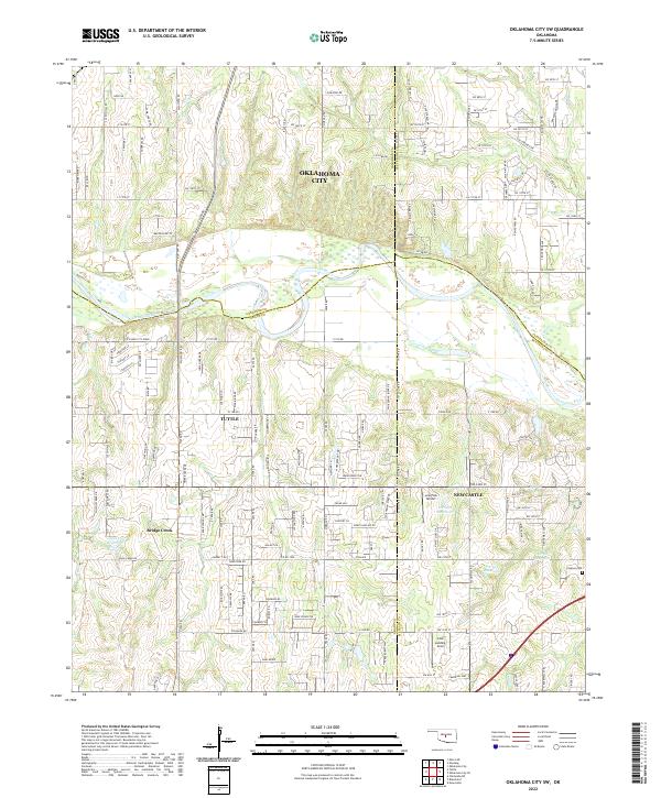
2022 Map of Oklahoma City SW
USGS Topo · Published 2022About this map
The Canadian River winds through this central Oklahoma landscape, marking the transition between the urban expansion of Oklahoma City and the growing rural-suburban corridors of Tuttle and Newcastle. The map reveals a high density of residential developments and rural roads, such as Kickapoo Dr and Jungle Rd, interspersed with significant natural landmarks like Bartons Butte and Cedar Hill.
Find a feature on this map
60 named features on this map. Tap any name to fly to it.
Don’t see what you’re looking for? This feature index may not catch every label — zoom into the map to look around manually.
Map Details
Editions of this 2022 Oklahoma City SW Map
This is the sole edition of this map. No revisions or reprints were ever made.
Other maps of this area

1893 · Oklahoma City
USGS Topo · 1:62,500

1893 · Minco
USGS Topo · 1:62,500

1904 · Chickasha
USGS Topo · 1:125,000

1954 · Oklahoma City
USGS Topo · 1:250,000

1956 · Oklahoma City
USGS Topo · 1:24,000

1956 · Oklahoma City
USGS Topo · 1:62,500

1956 · Oklahoma City SE
USGS Topo · 1:24,000

1957 · Oklahoma City
USGS Topo · 1:250,000

1963 · Oklahoma City
USGS Topo · 1:250,000
1965 · Newcastle
USGS Topo · 1:24,000