
1964 Map of Oklahoma Flat
USGS Topo · Published 1966About this map
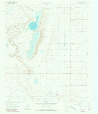
Yellow Lake and Illusion Lake dominate the northern landscape of this Texas Panhandle quadrangle, which documents the arid ranching and oil production environment of the early 1960s. The terrain is defined by the sharp escarpment of the High Plains and the winding course of Yellow House Draw, where historic land use is centered around the Yellow House Ranch and the small settlement of Oklahoma Flat. The map reveals a land managed for cattle, marked by numerous man-made water sources including Upper Goat Tank, South Pasture Tank, and Grapevine Tank. Industrial development is evident in the south, where the Yellow House Oil Field and scattered Gravel Pits indicate the extraction of natural resources from the High Plains soil. The boundary between Lamb and Hockley counties cuts across this landscape of draws and depressions.
Find a feature on this map
19 named features on this map. Tap any name to fly to it.
Don’t see what you’re looking for? This feature index may not catch every label — zoom into the map to look around manually.
Map Details
Editions of this 1964 Oklahoma Flat Map
2 editions found
Other maps of this area

1954 · Brownfield
USGS Topo · 1:250,000

1958 · Brownfield
USGS Topo · 1:250,000

1962 · Brownfield
USGS Topo · 1:250,000

1964 · Littlefield
USGS Topo · 1:24,000
1964 · Bull Lake
USGS Topo · 1:24,000

1964 · Pep
USGS Topo · 1:24,000

1964 · Lums Chapel
USGS Topo · 1:24,000
1964 · Beck
USGS Topo · 1:24,000

1964 · Whitharral
USGS Topo · 1:24,000

1965 · Hester Ranch
USGS Topo · 1:24,000