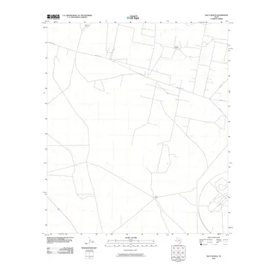
2010 Map of Old X Ranch
USGS Topo · Published 2010About this map
Worsham Ranch and Old X Ranch anchor this landscape in West Texas, reflecting the region's enduring ranching heritage. The presence of the Worsham Oil Field in the northeast corner signals the industrial layer of the Permian Basin, where energy extraction exists alongside traditional cattle operations. A sparse network of service roads and section lines defines the area, with Farm Rd 1450 cutting diagonally across the northern half. The map documents a specifically utilitarian geography of remote ranch outposts and petroleum infrastructure connected by unpaved routes like Co Rd 104 and Co Rd 103. This 2010 survey provides a clear view of the intersection between private landholdings and the oil industry in a corner of Reeves County where wide distances between named settlements remain the norm.
Find a feature on this map
6 named features on this map. Tap any name to fly to it.
Don’t see what you’re looking for? This feature index may not catch every label — zoom into the map to look around manually.
Map Details
Editions of this 2010 Old X Ranch Map
This is the sole edition of this map. No revisions or reprints were ever made.
Other maps of this area

1931 · Barstow
USGS Topo · 1:125,000

1954 · Pecos
USGS Topo · 1:250,000

1957 · Pecos
USGS Topo · 1:250,000

1963 · Ligon Ranch
USGS Topo · 1:24,000

1963 · Old X Ranch
USGS Topo · 1:24,000

1963 · Quito Draw
USGS Topo · 1:24,000

1963 · China Lake
USGS Topo · 1:24,000

1963 · Pecos East
USGS Topo · 1:24,000

1963 · Toyah Lake
USGS Topo · 1:24,000

1970 · Barstow 3 NE
USGS Topo · 1:24,000