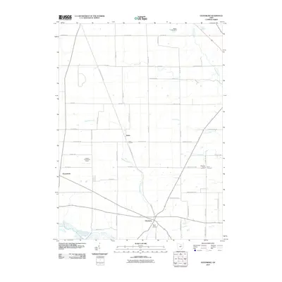
2010 Map of Olivesburg
USGS Topo · Published 2010About this map
Olivesburg and the rural townships of Ashland County appear here in a landscape defined by meandering waterways and agricultural road grids. The settlement of Adario sits at a central crossroads, anchoring a region where Whetstone Creek and Clear Creek cut across the township lines. For those researching local history, the map provides precise locations for several religious and memorial sites, including the Reformed Church and its adjacent Brytes Churchyard, as well as the Mount Olivet Cemetery south of town. The presence of the Oswalt Aerodrome Airport west of Adario introduces a modern element to a terrain otherwise dominated by names like Marks Lake Dam and the upper reaches of the Vermilion River, which flows through the northeastern corner of the study area near Baseline Rd.
Find a feature on this map
52 named features on this map. Tap any name to fly to it.
Don’t see what you’re looking for? This feature index may not catch every label — zoom into the map to look around manually.
Map Details
Editions of this 2010 Olivesburg Map
This is the sole edition of this map. No revisions or reprints were ever made.
Other maps of this area

1908 · Ashland
USGS Topo · 1:62,500

1908 · New London
USGS Topo · 1:62,500

1915 · Norwalk
USGS Topo · 1:62,500

1915 · Crestline
USGS Topo · 1:62,500

1943 · Crestline
USGS Topo · 1:62,500

1944 · Norwalk
USGS Topo · 1:62,500

1950 · Marion
USGS Topo · 1:250,000

1956 · Toledo
USGS Topo · 1:250,000

1960 · New London
USGS Topo · 1:24,000
1960 · Greenwich
USGS Topo · 1:24,000