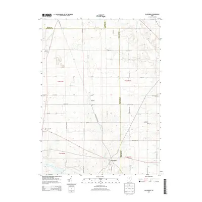
2013 Map of Olivesburg
USGS Topo · Published 2013About this map
The agricultural crossroad of Olivesburg anchors this northern Ohio landscape where three counties — Ashland, Richland, and Huron — converge. This 2013 survey illustrates a rural terrain defined by a network of township roads and small waterways, including Whetstone Cr and the Southwest Br Vermilion River. The settlement pattern centers around historic meeting points like Shenandoah and Adario, where local life is historically marked by small community clusters and several family or congregational burial grounds. Genealogists and local historians can find specifically named sites such as Mt Olivet Cem, Reformed Church Cem, and Brytes Churchyard. To the south, the terrain slopes toward the Black Fork Mohican River, reflecting the diverse drainage patterns of this fertile region.
Find a feature on this map
58 named features on this map. Tap any name to fly to it.
Don’t see what you’re looking for? This feature index may not catch every label — zoom into the map to look around manually.
Map Details
Editions of this 2013 Olivesburg Map
This is the sole edition of this map. No revisions or reprints were ever made.
Other maps of this area

1908 · Ashland
USGS Topo · 1:62,500

1908 · New London
USGS Topo · 1:62,500

1915 · Norwalk
USGS Topo · 1:62,500

1915 · Crestline
USGS Topo · 1:62,500

1943 · Crestline
USGS Topo · 1:62,500

1944 · Norwalk
USGS Topo · 1:62,500

1950 · Marion
USGS Topo · 1:250,000

1956 · Toledo
USGS Topo · 1:250,000

1960 · New London
USGS Topo · 1:24,000
1960 · Greenwich
USGS Topo · 1:24,000