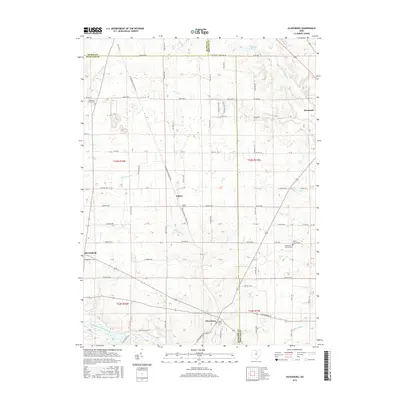
2016 Map of Olivesburg
USGS Topo · Published 2016About this map
Savannah and Adario anchor this agricultural landscape along the intersection of Ashland, Richland, and Huron counties. The terrain is defined by a dense network of township and county roads that follow the early grid system, including Baseline Rd and the Olivesburg Fitchville Rd. Waterways such as the Vermilion River and the Southwest Br Vermilion River drain the northern sections toward Lake Erie, while the Black Fork Mohican River touches the southern edge.
Find a feature on this map
76 named features on this map. Tap any name to fly to it.
Don’t see what you’re looking for? This feature index may not catch every label — zoom into the map to look around manually.
Map Details
Editions of this 2016 Olivesburg Map
This is the sole edition of this map. No revisions or reprints were ever made.
Other maps of this area

1908 · Ashland
USGS Topo · 1:62,500

1908 · New London
USGS Topo · 1:62,500

1915 · Norwalk
USGS Topo · 1:62,500

1915 · Crestline
USGS Topo · 1:62,500

1943 · Crestline
USGS Topo · 1:62,500

1944 · Norwalk
USGS Topo · 1:62,500

1950 · Marion
USGS Topo · 1:250,000

1956 · Toledo
USGS Topo · 1:250,000

1960 · New London
USGS Topo · 1:24,000
1960 · Greenwich
USGS Topo · 1:24,000