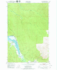
1949 Map of Oman Ranch
USGS Topo · Published 1979About this map
Agricultural life along the coastal river systems of Pacific County is defined by several family-named ranching operations established along the tidal flats. The Naselle River and its accompanying Slough dominate the lower landscape, where the Oman Ranch, S Ring Ranch, Ring Ranch, and Holm Ranch utilized the fertile lowlands. To the south, near the junction of Johnson Creek and O'Conner Creek, the Naselle State Salmon Hatchery stands as a key site for local resource management. The northern half of the territory is characterized by a dense network of watercourses including the North Middle Nemah, South Nemah, and Middle Nemah rivers, which carve through the rising timberland. These various ranching and fishery landmarks illustrate a landscape deeply tied to the intersection of freshwater drainage and the Pacific estuaries during the mid-century era.
Find a feature on this map
29 named features on this map. Tap any name to fly to it.
Don’t see what you’re looking for? This feature index may not catch every label — zoom into the map to look around manually.
Map Details
Editions of this 1949 Oman Ranch Map
5 editions found
Other maps of this area

1938 · Fort Columbia
USGS Topo · 1:62,500

1938 · South Bend
USGS Topo · 1:62,500

1940 · Brookfield
USGS Topo · 1:62,500

1940 · South Bend
USGS Topo · 1:62,500

1943 · Fort Columbia
USGS Topo · 1:62,500

1949 · Chinook
USGS Topo · 1:24,000

1949 · Upper Naselle River
USGS Topo · 1:24,000

1949 · Oman Ranch
USGS Topo · 1:24,000

1949 · Knappton
USGS Topo · 1:24,000

1949 · Rosburg
USGS Topo · 1:24,000