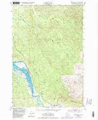
1949 Map of Oman Ranch
USGS Topo · Published 1985About this map
The coastal drainage of Pacific County is defined by the winding course of the Naselle River and the complex tidal waters of the Naselle Slough. This 1949 survey, based on aerial photography from the mid-1940s, documents a landscape dominated by family-named ranching operations along the riverbanks. Established sites like Oman Ranch, Siivola Ranch, and the W Ring Ranch illustrate the localized agricultural settlement patterns of this era.
Find a feature on this map
24 named features on this map. Tap any name to fly to it.
Don’t see what you’re looking for? This feature index may not catch every label — zoom into the map to look around manually.
Map Details
Editions of this 1949 Oman Ranch Map
5 editions found
Other maps of this area

1938 · Fort Columbia
USGS Topo · 1:62,500

1938 · South Bend
USGS Topo · 1:62,500

1940 · Brookfield
USGS Topo · 1:62,500

1940 · South Bend
USGS Topo · 1:62,500

1943 · Fort Columbia
USGS Topo · 1:62,500

1949 · Chinook
USGS Topo · 1:24,000

1949 · Upper Naselle River
USGS Topo · 1:24,000

1949 · Oman Ranch
USGS Topo · 1:24,000

1949 · Knappton
USGS Topo · 1:24,000

1949 · Rosburg
USGS Topo · 1:24,000