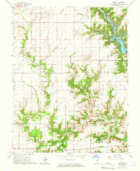
1965 Map of Omega
USGS Topo · Published 1968About this map
Stephen A Forbes State Lake dominates the northeastern landscape of this mid-1960s survey, its branching fingers creating a complex shoreline that contrasts with the surrounding agricultural grid. The settlement of Omega serves as a central point in a territory defined by small rural congregations and family burial grounds, including Pleasant Grove Ch, Lovella Grove Ch, and the curiously named Vatican Cem.
Find a feature on this map
28 named features on this map. Tap any name to fly to it.
Don’t see what you’re looking for? This feature index may not catch every label — zoom into the map to look around manually.
Map Details
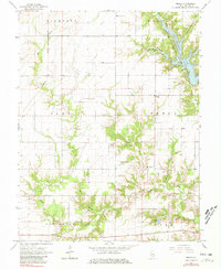
Editions of this 1965 Omega Map
2 editions found
Other maps of this area

1934 · Salem
USGS Topo · 1:62,500

1938 · Salem
USGS Topo · 1:62,500

1945 · Kinmundy
USGS Topo · 1:62,500

1947 · Kinmundy
USGS Topo · 1:62,500

1952 · Xenia
USGS Topo · 1:62,500

1956 · Edgewood
USGS Topo · 1:62,500

1958 · Belleville
USGS Topo · 1:250,000

1962 · Belleville
USGS Topo · 1:250,000

1965 · Iuka
USGS Topo · 1:24,000
1965 · Salem South
USGS Topo · 1:24,000