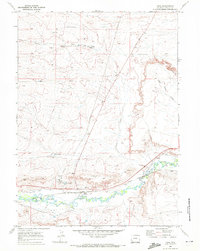
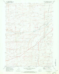
1969 Map of Opal
USGS Topo · Published 1972About this map
The settlement of Opal sits at a critical junction of infrastructure in the Wyoming high desert, positioned where the Union Pacific railroad tracks and multiple pipelines converge near the winding Hams Fork. This 1969 survey reveals an area defined by water management and transit, where irrigation features like the Anderson Ditch, Roberson Ditch, and South Side Ditch divert water to support the arid landscape. The map captures the industrial imprint on the land, including a Pumping Station and a Radio Tower, alongside the natural features of the Opal Bench. To the north, the terrain transitions into the grazing lands of Craven Creek Meadows, while the Opal Cutoff road traces a path across the high plains. This record is particularly valuable for documenting the mid-century utility footprint and the essential hydraulic engineering that sustained this corner of Lincoln County.
Find a feature on this map
21 named features on this map. Tap any name to fly to it.
Don’t see what you’re looking for? This feature index may not catch every label — zoom into the map to look around manually.
Map Details
Editions of this 1969 Opal Map
2 editions found
Other maps of this area

1954 · Ogden
USGS Topo · 1:250,000

1958 · Ogden
USGS Topo · 1:250,000

1960 · Ogden
USGS Topo · 1:250,000

1969 · Church Butte NW
USGS Topo · 1:24,000

1969 · Willow Springs
USGS Topo · 1:24,000

1969 · Roberson Creek
USGS Topo · 1:24,000
1969 · Shute Creek Lake
USGS Topo · 1:24,000
1969 · Round Mountain
USGS Topo · 1:24,000
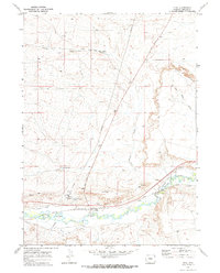
1969 · Opal
USGS Topo · 1:24,000
1969 · Graham Reservoir
USGS Topo · 1:24,000