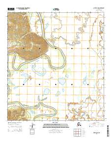
2015 Map of Ophir B-5 NE
USGS Topo · Published 2015About this map
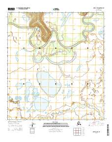
The Innoko River winds through a vast alluvial landscape in this interior Alaskan interior, creating a complex network of oxbow lakes, abandoned channels, and wetlands. This hydrological environment is characterized by the river’s dramatic meanders as it flows through the western edge of the quadrangle and crosses back again further south. The proximity of Hammer Cr and Grouch Cr suggests a region defined by seasonal water movement and shifting drainage patterns. Without established roads or settlements printed on this sheet, the natural waterways remain the primary landmarks for navigation and local history. The map provides a precise look at the township and range boundaries, including t23s r3e and t24s r4e, which help ground the wilderness within the Public Land Survey System.
Find a feature on this map
7 named features on this map. Tap any name to fly to it.
Don’t see what you’re looking for? This feature index may not catch every label — zoom into the map to look around manually.
Map Details
Editions of this 2015 Ophir B-5 NE Map
This is the sole edition of this map. No revisions or reprints were ever made.
Other maps of this area

1951 · Ophir
USGS Topo · 1:250,000

1954 · Ophir C-5
USGS Topo · 1:63,360

1954 · Ophir B-4
USGS Topo · 1:63,360

1954 · Ophir B-5
USGS Topo · 1:63,360

1954 · Ophir C-4
USGS Topo · 1:63,360

1954 · Ophir
USGS Topo · 1:250,000
2014 · Ophir B-5 SW
USGS Topo · 1:25,000
2014 · Ophir B-5 NW
USGS Topo · 1:25,000
2014 · Ophir C-5 SW
USGS Topo · 1:25,000
2015 · Ophir C-4 SW
USGS Topo · 1:25,000