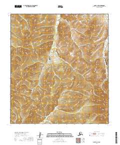
2019 Map of Ophir C-1 SE
USGS Topo · Published 2019About this map
Folger sits at the heart of this high-elevation landscape, where the ridges of the Kuskokwim Mountains and the Cripple Creek Mountains dominate the terrain. This interior Alaskan environment is defined by its network of drainages, including Bear Cr, Quartz Cr, and Shorty Cr, which carve through the uplands. Access to this remote region is centered on small aviation hubs like Bear Creek 3 Airport and Colorado Creek Airport, illustrating the reliance on air travel for transit between isolated outposts. The map reveals a land structured by the Public Land Survey System, with township lines like t22s r14e and t23s r15e dividing the wilderness into a grid of sections. These survey markers, alongside labels for Caribou Cr and Butte Cr, provide the primary points of reference for researchers and landowners in this sparsely populated portion of the Yukon-Koyukuk Census Area.
Find a feature on this map
21 named features on this map. Tap any name to fly to it.
Don’t see what you’re looking for? This feature index may not catch every label — zoom into the map to look around manually.
Map Details
Editions of this 2019 Ophir C-1 SE Map
This is the sole edition of this map. No revisions or reprints were ever made.
Other maps of this area

1950 · Medfra
USGS Topo · 1:250,000

1951 · Ophir
USGS Topo · 1:250,000

1954 · Medfra C-6
USGS Topo · 1:63,360

1954 · Medfra B-6
USGS Topo · 1:63,360

1954 · Ophir C-1
USGS Topo · 1:63,360

1954 · Ophir B-1
USGS Topo · 1:63,360

1954 · Ophir
USGS Topo · 1:250,000

1959 · Medfra
USGS Topo · 1:250,000
2019 · Ophir C-1 NE
USGS Topo · 1:25,000
2019 · Medfra C-6 SW
USGS Topo · 1:25,000