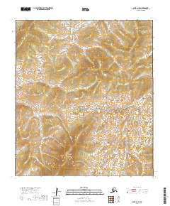
2019 Map of Ophir D-1 SE
USGS Topo · Published 2019About this map
Hunch Mtn rises above a wilderness landscape in the interior of the Yukon-Koyukuk region, anchoring a terrain defined by high ridgelines and the headwaters of the Kuskokwim drainage. This 2019 survey documents the complex hydrological patterns of the Innoko country, where Tango Cr and Fourmile Cr navigate the high-elevation valleys before joining larger systems downstream. The presence of Slow Cr suggests the shifting pace of the water as it leaves the steeper slopes of the mountains for more level ground. This map provides a technical view of the Public Land Survey System grid across multiple townships, including t19s r14e and t20s r14e, illustrating how modern geographic boundaries are projected onto a vast, roadless environment.
Find a feature on this map
10 named features on this map. Tap any name to fly to it.
Don’t see what you’re looking for? This feature index may not catch every label — zoom into the map to look around manually.
Map Details
Editions of this 2019 Ophir D-1 SE Map
This is the sole edition of this map. No revisions or reprints were ever made.
Other maps of this area

1950 · Medfra
USGS Topo · 1:250,000

1951 · Ophir
USGS Topo · 1:250,000

1954 · Medfra C-6
USGS Topo · 1:63,360

1954 · Medfra D-6
USGS Topo · 1:63,360
1954 · Ophir D-1
USGS Topo · 1:63,360

1954 · Ophir C-1
USGS Topo · 1:63,360

1954 · Ophir
USGS Topo · 1:250,000

1959 · Medfra
USGS Topo · 1:250,000
2019 · Ophir C-1 NE
USGS Topo · 1:25,000
2019 · Ophir D-1 NE
USGS Topo · 1:25,000