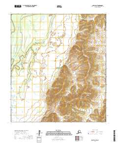
2017 Map of Ophir D-6 NE
USGS Topo · Published 2017About this map
Innoko National Wildlife Refuge dominates this sub-arctic landscape in the Yukon-Koyukuk region, revealing a complex network of wetlands and drainage patterns. The terrain transitions from the low-lying meandering waterways of the west into the prominent elevations of the Kalyuh Mountains in the southeast. A single significant watercourse, Roketaloi Cr, descends from these heights, cutting through the eastern foothills. The map provides a detailed look at the Public Land Survey System grid, including townships t17s r1e, t17s r2e, t18s r1e, t18s r2e, t19s r1e, and t19s r2e. This 2017 survey documents a vast, uninhabited wilderness area where the natural topography remains the primary feature, undisturbed by permanent settlements or road infrastructure.
Find a feature on this map
9 named features on this map. Tap any name to fly to it.
Don’t see what you’re looking for? This feature index may not catch every label — zoom into the map to look around manually.
Map Details
Editions of this 2017 Ophir D-6 NE Map
This is the sole edition of this map. No revisions or reprints were ever made.
Other maps of this area

1945 · Nulato
USGS Topo · 1:250,000

1951 · Ophir
USGS Topo · 1:250,000

1951 · Nulato
USGS Topo · 1:250,000

1952 · Nulato A-5
USGS Topo · 1:63,360

1952 · Nulato
USGS Topo · 1:250,000

1952 · Nulato A-6
USGS Topo · 1:63,360
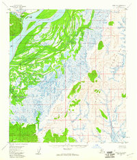
1954 · Ophir D-6
USGS Topo · 1:63,360
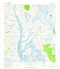
1954 · Ophir D-5
USGS Topo · 1:63,360

1954 · Ophir
USGS Topo · 1:250,000

1964 · Nulato
USGS Topo · 1:250,000