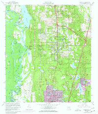
1964 Map of Orange City
USGS Topo · Published 1971About this map
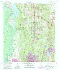
The St Johns River defines the western edge of this landscape, creating a complex network of waterways including Snake Cr Cutoff, Huntoon River, and The Basin. This aquatic environment contrasts sharply with the upland settlements to the east, where Orange City and DeBary were established along the Seaboard Coast Line railroad. The 1970 photorevisions highlight the rapid expansion of Deltona in the southeast, characterized by a dense, planned street grid including Elkcam Blvd and Normandy Blvd. Notable local landmarks and community centers such as Mt Berrain Ch, Coleman Sch, and several cemeteries provide specific points of interest for genealogical research. The transition from the riverine environment of Huntoon Island to the burgeoning suburban developments around Lake Laponoca captures a pivotal moment of growth in this part of Florida.
Find a feature on this map
84 named features on this map. Tap any name to fly to it.
Don’t see what you’re looking for? This feature index may not catch every label — zoom into the map to look around manually.
Map Details
Editions of this 1964 Orange City Map
5 editions found
Other maps of this area

1954 · Daytona Beach
USGS Topo · 1:250,000

1955 · Orlando
USGS Topo · 1:250,000

1957 · Orlando
USGS Topo · 1:250,000

1958 · Orlando
USGS Topo · 1:250,000

1958 · Daytona Beach
USGS Topo · 1:250,000

1962 · Orlando
USGS Topo · 1:250,000

1962 · Pine Lakes
USGS Topo · 1:24,000

1962 · Daytona Beach SW
USGS Topo · 1:24,000

1962 · Lake Woodruff
USGS Topo · 1:24,000

1964 · Daytona Beach
USGS Topo · 1:250,000