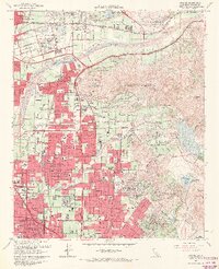
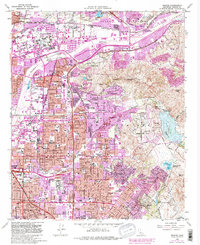
1964 Map of Orange
USGS Topo · Published 1970About this map
The Santa Ana River carves through this mid-1960s landscape, illustrating a pivotal moment when the historic citrus-growing regions of Orange and Anaheim were rapidly transforming into suburban residential hubs. The map captures the interface between industrial development and local heritage, marked by the Yorba Hacienda Historical Marker and older settlements like Olive and McPherson. To the east, the terrain rises into the Peralta Hills and Cerro Villa Heights, where the Peters Canyon Reservoir and Lower Peters Canyon Reservoir served as critical water infrastructure for the growing population. Detailed school placements, including Villa Park High Sch and Foothill High Sch, reflect the era's civic expansion, while the presence of the At & SF and Southern Pacific railroads alongside newer routes like the Riverside Freeway show the evolution of California transportation.
Find a feature on this map
68 named features on this map. Tap any name to fly to it.
Don’t see what you’re looking for? This feature index may not catch every label — zoom into the map to look around manually.
Map Details
Editions of this 1964 Orange Map
5 editions found
Other maps of this area

1896 · Santa Ana
USGS Topo · 1:62,500

1896 · Anaheim
USGS Topo · 1:62,500

1898 · Anaheim
USGS Topo · 1:62,500

1901 · Southern California Sheet No. 1
USGS Topo · 1:250,000

1901 · Santa Ana
USGS Topo · 1:62,500

1901 · Anaheim
USGS Topo · 1:62,500

1902 · Corona
USGS Topo · 1:125,000

1904 · Southern California Sheet No. 1
USGS Topo · 1:250,000

1932 · Orange
USGS Topo · 1:31,680

1932 · Newport Beach
USGS Topo · 1:31,680