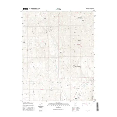
2017 Map of Orderville
USGS Topo · Published 2017About this map
Orderville and Mount Carmel anchor this 2017 survey of the Long Valley corridor, a region defined by the winding course of the E Fork Virgin River and the dramatic verticality of the Elkheart Cliffs. The settlement pattern follows the narrow fertile stretches along the river, where residential streets like S Center St and Pinyon Pine Dr meet the primary artery of W State St. Local history and genealogy are anchored at the Orderville Cem and the Po, situated just south of Gardner Hollow.
Find a feature on this map
53 named features on this map. Tap any name to fly to it.
Don’t see what you’re looking for? This feature index may not catch every label — zoom into the map to look around manually.
Map Details
Editions of this 2017 Orderville Map
This is the sole edition of this map. No revisions or reprints were ever made.
Other maps of this area

1886 · Kanab
USGS Topo · 1:250,000

1953 · Cedar City
USGS Topo · 1:250,000

1954 · Orderville Canyon SE
USGS Topo · 1:24,000

1956 · Springdale NE
USGS Topo · 1:24,000

1957 · Orderville Canyon NE
USGS Topo · 1:24,000

1957 · Kanab
USGS Topo · 1:62,500

1958 · Cedar City
USGS Topo · 1:250,000

1958 · Orderville
USGS Topo · 1:62,500

1962 · Cedar City
USGS Topo · 1:250,000
1980 · Clear Creek Mountain
USGS Topo · 1:24,000