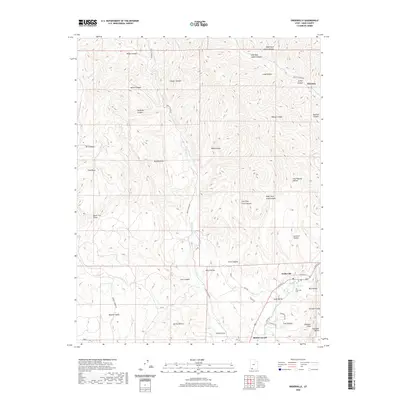
2020 Map of Orderville
USGS Topo · Published 2020About this map
Orderville, Glendale, and Mount Carmel anchor this 2020 topographical study of Kane County, situated within the distinctive corridor of Long Valley. The landscape is defined by the E Fork Virgin River and a dense network of drainages including Meadow Cr and Muddy Cr. The geography transitions from the high, flat Glendale Bench down through the striking Elkheart Cliffs, revealing the complex erosion patterns that have carved numerous hollows and canyons such as Coal Hollow, Red Hollow, and Bishop Canyon.
Find a feature on this map
51 named features on this map. Tap any name to fly to it.
Don’t see what you’re looking for? This feature index may not catch every label — zoom into the map to look around manually.
Map Details
Editions of this 2020 Orderville Map
This is the sole edition of this map. No revisions or reprints were ever made.
Other maps of this area

1886 · Kanab
USGS Topo · 1:250,000

1953 · Cedar City
USGS Topo · 1:250,000

1954 · Orderville Canyon SE
USGS Topo · 1:24,000

1956 · Springdale NE
USGS Topo · 1:24,000

1957 · Orderville Canyon NE
USGS Topo · 1:24,000

1957 · Kanab
USGS Topo · 1:62,500

1958 · Cedar City
USGS Topo · 1:250,000

1958 · Orderville
USGS Topo · 1:62,500

1962 · Cedar City
USGS Topo · 1:250,000
1980 · Clear Creek Mountain
USGS Topo · 1:24,000