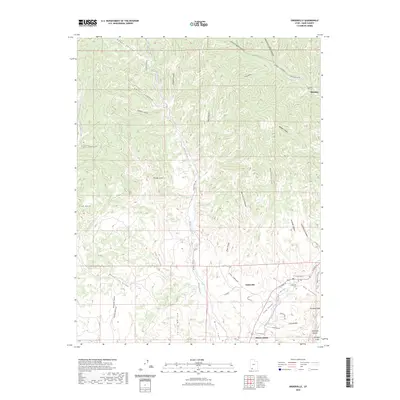
2023 Map of Orderville
USGS Topo · Published 2023About this map
Long Valley serves as the central corridor for this part of southern Utah, where the East Fork Virgin River winds between steep canyon walls and expansive plateaus. The settlements of Orderville, Glendale, and Mount Carmel are positioned along this river valley, which has long been a vital north-south passage through the high desert. To the east, the landscape rises sharply into the Elkheart Cliffs and the Glendale Bench, while the western side is dominated by a complex network of drainages including Mineral Gulch and Tait Canyon. Local history is anchored at the Orderville Cem and marked by landmarks such as the Orderville Towers. The intricate topography of Cove Canyon and Lydias Canyon demonstrates the erosive power of the water systems like Muddy Creek that have carved through the colored rock layers of the region.
Find a feature on this map
49 named features on this map. Tap any name to fly to it.
Don’t see what you’re looking for? This feature index may not catch every label — zoom into the map to look around manually.
Map Details
Editions of this 2023 Orderville Map
This is the sole edition of this map. No revisions or reprints were ever made.
Other maps of this area

1886 · Kanab
USGS Topo · 1:250,000

1953 · Cedar City
USGS Topo · 1:250,000

1954 · Orderville Canyon SE
USGS Topo · 1:24,000

1956 · Springdale NE
USGS Topo · 1:24,000

1957 · Orderville Canyon NE
USGS Topo · 1:24,000

1957 · Kanab
USGS Topo · 1:62,500

1958 · Cedar City
USGS Topo · 1:250,000

1958 · Orderville
USGS Topo · 1:62,500

1962 · Cedar City
USGS Topo · 1:250,000
1980 · Clear Creek Mountain
USGS Topo · 1:24,000