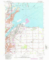
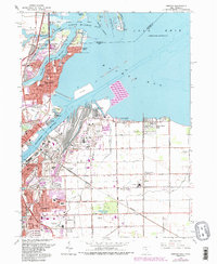
1965 Map of Oregon
USGS Topo · Published 1986About this map
The industrial and maritime landscape of Toledo and Oregon unfolds along the Maumee River and Maumee Bay in this mid-century survey. The area's character is defined by a dense intersection of shipping and rail infrastructure, featuring the Toledo Terminal RR and the Norfolk and Western lines serving the waterfront drydocks and numerous sludge pits. The map captures several distinct residential pockets like Harbor View, Ironville, and Momeneetown, alongside community anchors such as St Ignatius Ch and Clay High Sch.
Find a feature on this map
85 named features on this map. Tap any name to fly to it.
Don’t see what you’re looking for? This feature index may not catch every label — zoom into the map to look around manually.
Map Details
Editions of this 1965 Oregon Map
5 editions found
Other maps of this area

1900 · Maumee Bay
USGS Topo · 1:62,500

1900 · Toledo
USGS Topo · 1:62,500

1912 · Monroe
USGS Topo · 1:62,500

1912 · Dundee
USGS Topo · 1:62,500

1914 · Monroe
USGS Topo · 1:62,500

1926 · Dundee
USGS Topo · 1:62,500

1934 · Reno Beach
USGS Topo · 1:24,000

1934 · Point Place
USGS Topo · 1:24,000

1934 · Rossford
USGS Topo · 1:24,000

1935 · Walbridge
USGS Topo · 1:24,000