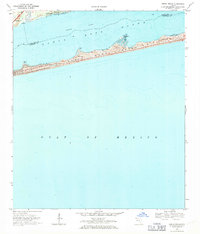
1969 Map of Oriole Beach
USGS Topo · Published 1971About this map
Santa Rosa Island stretches across the center of this coastal survey, defined by a series of prominent sand dunes and several named coastal projections including Big Sabine Point, Range Point, and Sharp Point. To the north, the protected waters of Santa Rosa Sound separate the barrier island from the mainland settlements of Gulf Breeze and Oriole Beach. The marine landscape is deeply tied to the Intracoastal Waterway, which serves as a vital transit corridor through the sound, while the southern shore meets the vast expanse of the Gulf of Mexico. On the island itself, the presence of Via Deluna indicates the early residential and recreational development of this shoreline during the late 1960s. The map also clearly delineates the maritime border between Santa Rosa and Escambia counties as it passes through the sound and across the barrier strand.
Find a feature on this map
14 named features on this map. Tap any name to fly to it.
Don’t see what you’re looking for? This feature index may not catch every label — zoom into the map to look around manually.
Map Details
Editions of this 1969 Oriole Beach Map
4 editions found
Other maps of this area

1921 · Holley
USGS Topo · 1:62,500

1921 · Pensacola
USGS Topo · 1:62,500

1936 · Holley
USGS Topo · 1:48,000

1938 · Holley
USGS Topo · 1:62,500

1941 · Pensacola
USGS Topo · 1:62,500

1942 · Pensacola
USGS Topo · 1:62,500
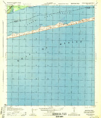
1944 · Oriole Beach
USGS Topo · 1:25,000

1944 · Gulf Breeze
USGS Topo · 1:25,000
1944 · Garcon Point
USGS Topo · 1:25,000
1944 · Pensacola
USGS Topo · 1:25,000