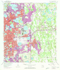
1956 Map of Orlando East
USGS Topo · Published 1972About this map
The eastern reaches of Orlando and Winter Park are defined here by an intricate chain of citrus-era lakes and rapidly expanding mid-century infrastructure. Major institutional hubs anchor the landscape, most notably the sprawling Orlando Naval Training Center and the Herndon Municipal Airport, reflecting the region's importance to military training and civil aviation during the Cold War. To the north, the historic campus of Rollins College sits along Lake Virginia, while the Seaboard Coast Line connects smaller outlying communities like Goldenrod and Union Park.
Find a feature on this map
109 named features on this map. Tap any name to fly to it.
Don’t see what you’re looking for? This feature index may not catch every label — zoom into the map to look around manually.
Map Details
Editions of this 1956 Orlando East Map
4 editions found
Other maps of this area

1953 · Lake Jessamine
USGS Topo · 1:24,000

1953 · Pine Castle
USGS Topo · 1:24,000

1953 · Oviedo SW
USGS Topo · 1:24,000

1953 · Narcoossee NW
USGS Topo · 1:24,000

1955 · Orlando
USGS Topo · 1:250,000

1956 · Oviedo
USGS Topo · 1:24,000

1956 · Orlando West
USGS Topo · 1:24,000

1956 · Orlando East
USGS Topo · 1:24,000

1957 · Orlando
USGS Topo · 1:250,000

1958 · Orlando
USGS Topo · 1:250,000